Map Search and Parcel Discovery
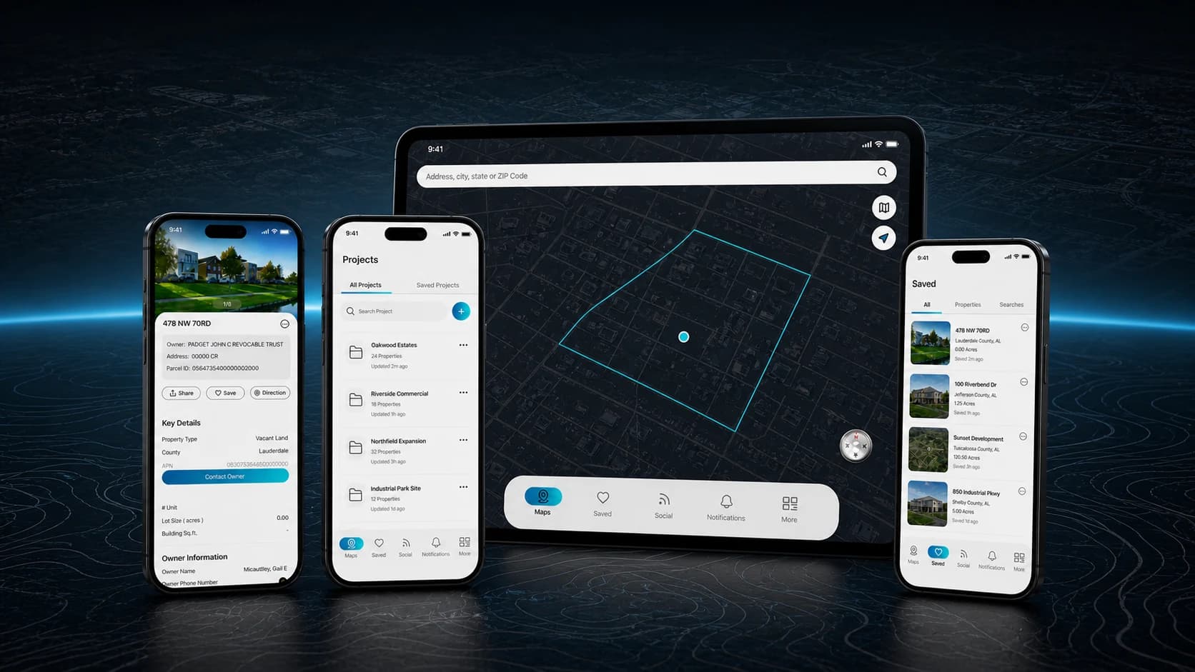
Address, city, state, and ZIP search combine with map controls, current location, map-type selection, parcel selection, and approximate boundary guidance.
 +971 50 774 5600
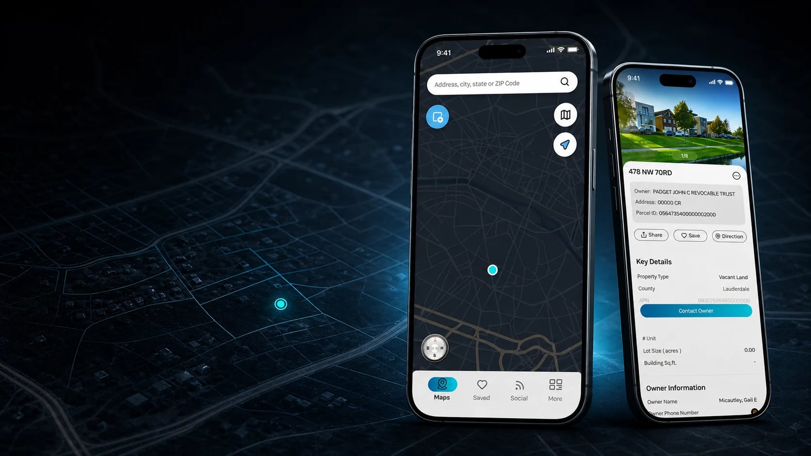
Aerial Reconnaissance brings parcel discovery, property intelligence, saved records, project organization, and geospatial file exchange into one mobile-first workspace for land professionals.
Core Experience
Parcel Intelligence
Primary Workflow
Map to Project
Professional Modes
Developer, Surveyor & Enterprise
Platform
Mobile App
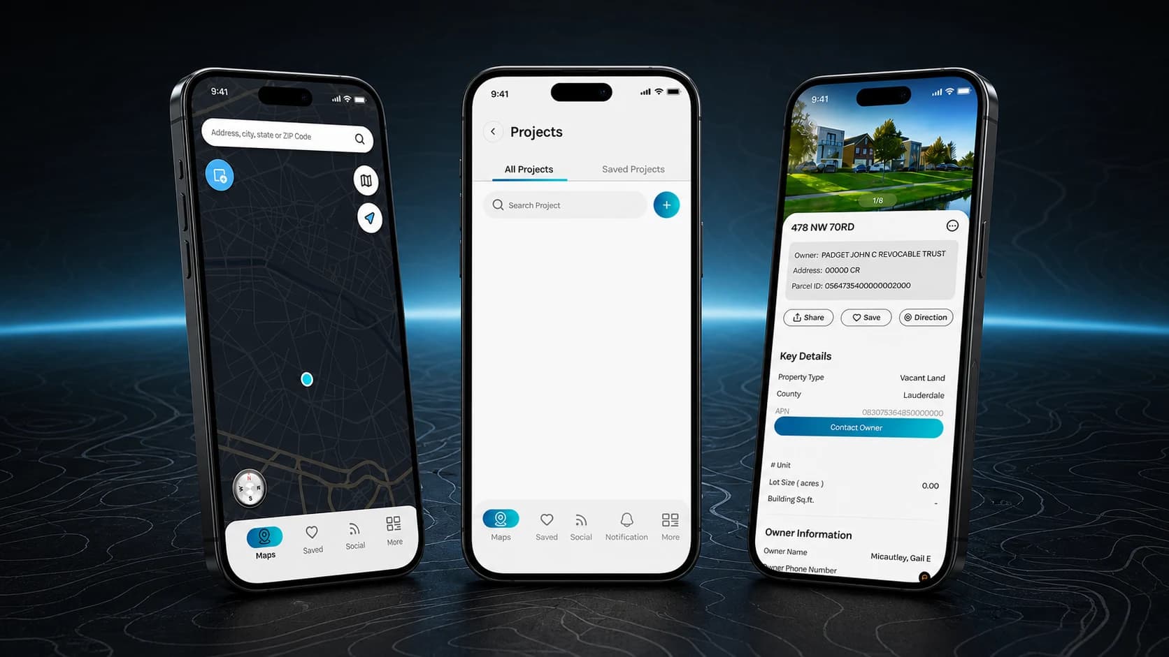
Aerial connects the field journey from searching an address or ZIP code to reviewing a property record, saving a parcel, and organizing it inside a project. The product keeps owner information, land characteristics, tax and valuation context, zoning data, team visibility, and geospatial imports or exports within one consistent mobile workflow.
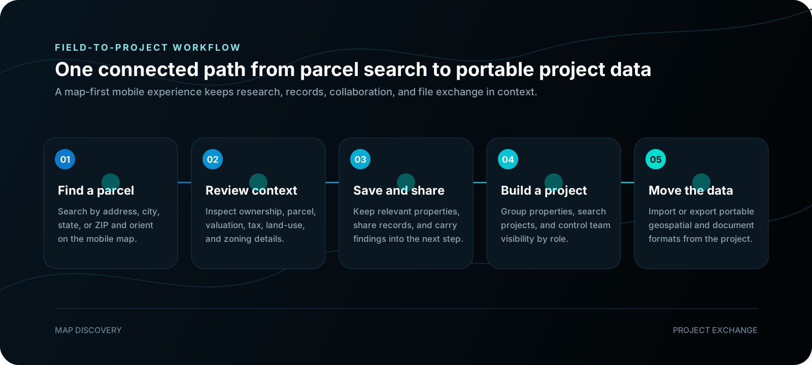
Land professionals often move between map tools, parcel records, owner and valuation data, field notes, and disconnected project files before they can act on a property.
The product needed to make dense property information usable on a phone while supporting distinct needs for developers, surveyors, and enterprise teams.

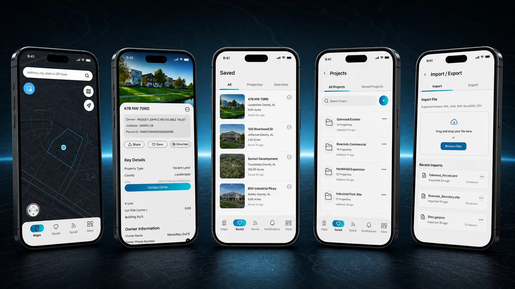
The verified product scope connects parcel research with the mobile tools required to evaluate properties, preserve findings, organize projects, and exchange land data across professional workflows.
Address, city, state, and ZIP search combine with map controls, current location, map-type selection, parcel selection, and approximate boundary guidance.
Property profiles organize parcel identifiers, ownership, addresses, land and building characteristics, valuation, sales, taxes, zoning, land use, and vacancy context.
Users can preserve relevant parcels, revisit saved records, share property context, copy parcel links, get directions, and report issues from the mobile experience.
Project creation, search, saved projects, property grouping, and visibility controls for developers, surveyors, or the full team turn parcel research into an organized workspace.
Project data can move through mobile import and export workflows using formats represented in the product design, including KMZ, KML, CSV, DXF, and PDF.
Developer, surveyor, and enterprise modes sit alongside onboarding, authentication, permissions, account settings, and subscription journeys within one coherent mobile design system.
Always busy and want to book an exact time to call?